
As stated above, tomorrow will be June 1, which is the official start to the Hurricane Season. Many are predicting an above average season, with NOAA forecasting 12-18 named storms, 6-10 hurricanes of which 3-6 could become major hurricanes with winds in excess of 111mph or greater. I'm predicting 18 named storms, 11 hurricanes of which 5 will be major. I'll admit, this is a pretty bullish forecast with La Nina going into a neutral state and the possibility of a weak El Nino developing by October. I will admit that I am no professional hurricane forecaster (this is the first time I've put a number out there predicting the number of storms), but I am using this as a learning experience. BTW, here is the current view of the western Atlantic Basin:
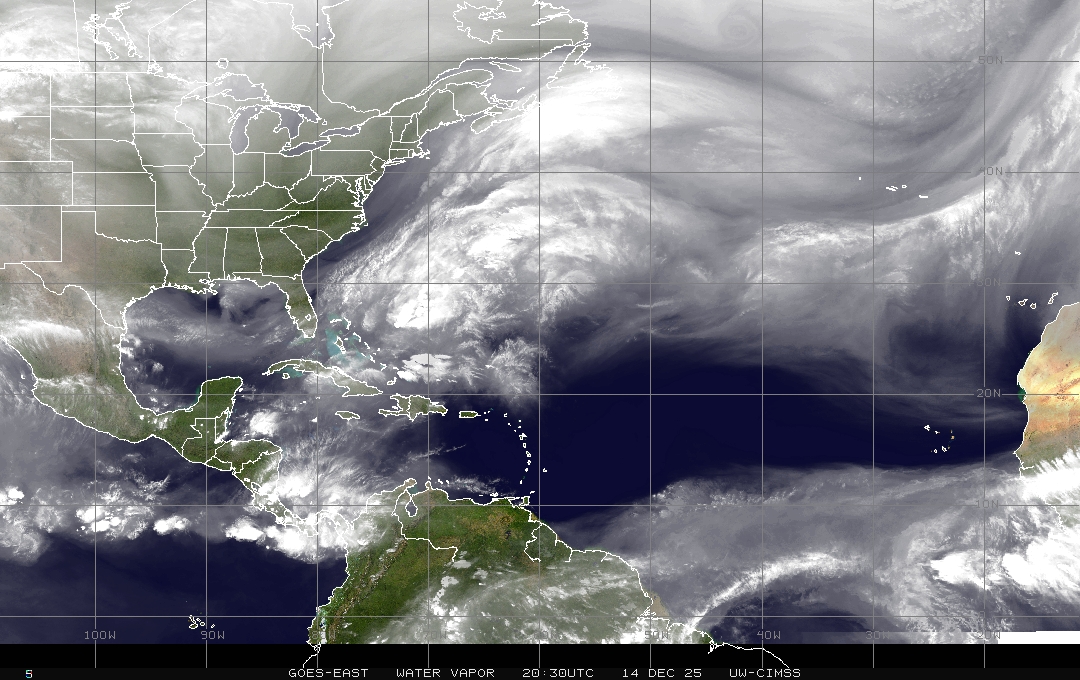
Note the convection near Nicaragua. I believe this will be Invest 93L by the weekend. The limiting factors for development of this system are strong wind shear (notice the cloud tops being blown off to the northeast) and the lack of a circulation (at least for the time being). Models still want to develop this system over the next few days, so I'll keep an eye on it for any further developments.
Now for the Eastern Atlantic Basin:
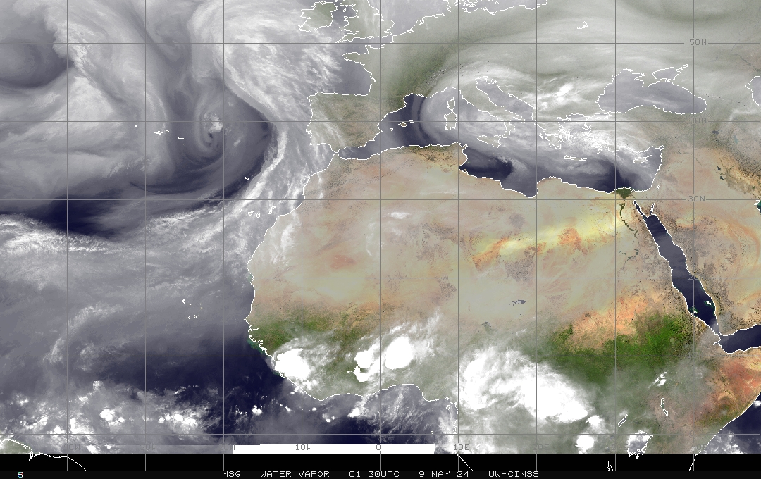
The Inter-Tropical Convergence Zone (ITCZ) is still a tad too far south to be concerned with at this point. Though, it is looking healthy, with a few potential disturbances set to move off the coast of Africa in the coming weeks.