A quick recap of this past weekend's weather shows we managed to stay below 100 both Saturday and Sunday, with 98 and 99 respectively.
Today, we managed to hit the century mark in Columbus yet again. This is below our record high of 103 set back in 1985, so no new record for today. A look at the radar is not good news for our area at this time. Storms are firing to the north of Atlanta, east of Vidalia, and near Tallahassee, FL, while we are dry as a bone. There isn't much hope for the next few days either, as the ridge of high pressure that meandered to the west over the weekend is now migrating east.
As we progress toward Thursday, things become interesting. A trough of low pressure is forecast to move into the central plains (that's why the high is forecast to move east). In doing so, it will allow the tropical low I've been following to finally make it into the Gulf of Mexico. This low MAY become our first Tropical Depression of the season, but won't last long as I'll discuss in a minute. The effects it will have for our area is there will be an influx of tropical moisture to allow a better chance for showers and thunderstorms. Again, the track of the low will be HIGHLY dependent on where the high pressure ultimately settles. If the low moves more toward the west, we'll actually be in the position receive a stray shower or storm. If it moves more to the east, we'll be DRY. If it moves too far in either direction, we'll be dry as well.
This forecast all depends on what the low does for your upcoming weekend. Temperatures tomorrow will be in the upper 90s, Wednesday thru Monday will see highs in the mid 90s with a slight chance of storms every single day. Again, if that low from the Gulf gets close to us, we'll increase your rain chances for Friday and Saturday.
Now, for a more detailed look at the low in the Caribbean.

The National Hurricane Center has given the low in the Caribbean a 50% chance of development within the next 48 hours. The computer models brings this system into the Gulf of Mexico within the next 3 days and eventually into the northern Gulf Coast.

The models appear to be correct with the direction this system is heading, though it's too early to tell exactly where the center of circulation will make landfall. I can confidently say that this system will likely NOT be a tropical storm or hurricane when it gets close to land. There is just too much wind shear in the Gulf of Mexico due to an upper level low spinning over the Gulf. This will inhibit strengthening and means we won't be talking about a hurricane in the Gulf. However, it will be a rainmaker for where ever it does go. This will be GREAT news anywhere along the Gulf states as most of us are under some sort of drought conditions, so the rain will be welcome relief.
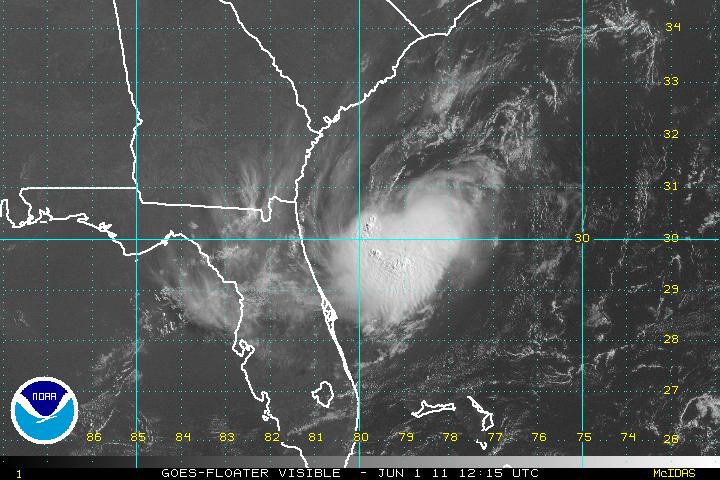
I'll leave you with this:

This is the satellite view of the low in question. It doesn't look all that impressive, but a low level circulation (llc) has developed just to the southwest of Jamaica. I'll continue to track it until it is no longer a threat to anyway. Have a great evening!