After an average day yesterday, we'll begin a warming trend to end 2011. A few weak disturbances will ride along the jetstream; allowing me to forecast a few high clouds the next couple of days.
Today:
Morning lows are dipping into the low 30s on the heels of a relatively clear sky, a few high clouds for our southern viewers, and calm winds. As with yesterday, we'll see a mostly sunny sky that will warm us up near 60.
Tomorrow and Saturday:
As mentioned at the beginning of the post, 2011 will end with a warming trend. Highs increase a few degrees each day with low to mid 60s tomorrow and mid to upper 60s Saturday. At least you don't have to worry about the weather if you're making New Year's Eve plans outside as it will be dry and mild. Both afternoons will see clouds stream through as a series of weak disturbances ride along the jetstream.
First week of 2012:
Monday - Wednesday:
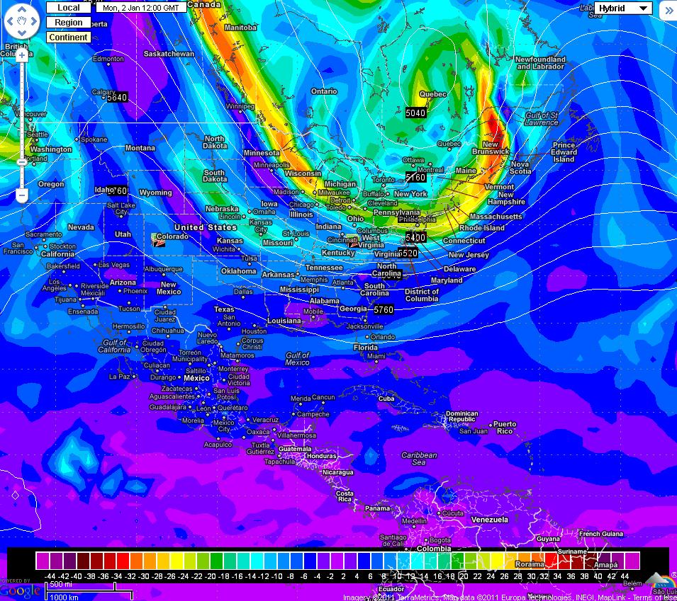
If you've followed this blog the past few days, then you know about the big chill that's about to invade the eastern half of the country next week. The models are coming into better agreement with the location of the initial trough. The GFS has come in a tad stronger but the overall location is still for the northeast. The Euro is not as strong and is locating farther to the northeast. This is the trend I mentioned a few posts ago. The Euro looked a little too extreme earlier this week while the GFS didn't look strong enough. This solution looks more plausible, at least to me, and will likely be what happens next Monday. Here are the images:
00Z GFS:
00Z Euro:

Either way, that's a mighty cold look for us in the southeast. I'm forecasting highs in the mid 40s for Tuesday and Wednesday, with the chilly weather continuing into the end of the week. As of now, the raw model data has us in the upper 30s next Tuesday and low to mid 40s next Wednesday:

Thursday - Saturday:
The models are amazingly similar with the second piece of energy, mentioned at the end of yesterday's post, forecast to ride down the back of the trough mentioned above.
00Z GFS for next Thursday morning:

00Z Euro for next Thursday morning:

No comments:
Post a Comment